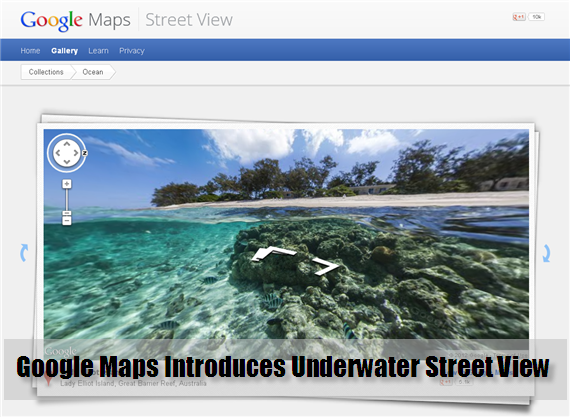
Google Maps is one of the hottest news as of the moment especially if we talk about Apple iOS 6 using their own map app instead of Google Maps. But I am not here to discuss about that, maybe on another topic. I am here to introduce to you the most recent and amazing innovations from the Google Maps team. Meet the new addition into their Street Map view – the very first underwater panoramic images. I was not born to swim although I know the basics but I envy those people who could dive meters away from the ocean floor and see the coral reefs, different and underwater living things, and most especially the scenery underneath. Now, not only I would be able to have that chance to take a peek into these majestic places not known to many of us and what’s more cool about it is that it’s totally free.
Google Maps in partnership with The Catlin Seaview Survey (a company whose major focus is studying the reefs) have now integrated these images as part of their services to provide a more usable and comprehensive map of the world. Their collection of images is not yet fully complete but enough (as of the moment) for you to experience what these new innovations can bring to you.
Some of the featured galleries that they have as of the moment will take you to wonderful places like Heron Island and Lady Elliot Island from Australia, Apo from the Philippines, and many more. Here’s a quick preview made by Google Maps showcasing how wonderful this new features.
It is now time for some wild thoughts and wishful thinking. We are all aware and thankful how Google Maps application helped us for years like if we need to know the location of a certain place, this application provides us at least if not accurate, close to the place. But most of these maps whether it is a satellite view, 2D, street view, hybrid, or even indoors, they are all land-based. And with the birth of ocean-based in Google Maps there are so many possibilities that can be added with this feature. I mean, in the next years, or centuries, maybe by that time people can use Google Maps to check-in while they are on a tour in the middle of the ocean. Or send their location when something unfortunate incident occurs while they are on a voyage or travelling. Why not? People keeps on innovating technologies and these could probably save lives when it is implemented.
For more information about the new Google Maps Underwater Street View, check their article about this enhancement or check out their full ocean gallery collection. You can also check here the other Google Maps Tips and Tricks.


